

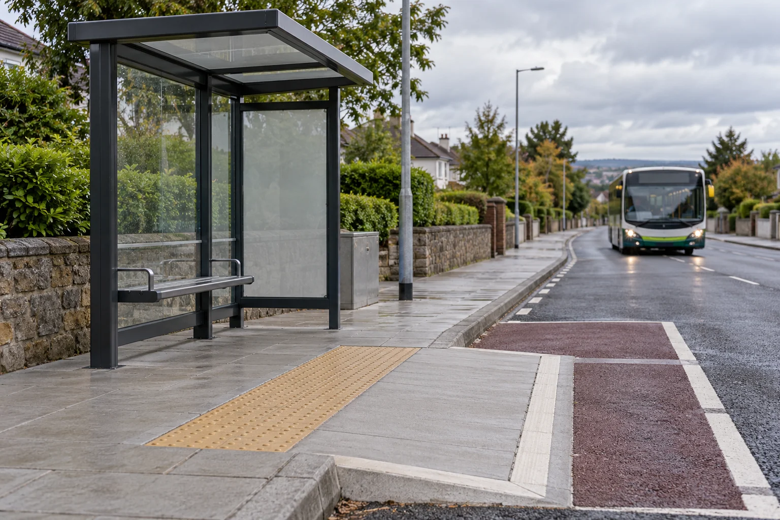
Kildare County Council has opened a public consultation on proposed changes at six bus stops in Kildare town and Rathangan, including plans that could remove a stretch of parking on Rathangan’s Main Street. The consultation began at 8am on Tuesday, 27 October, and submissions are due by 5pm on Friday, 27 November 2026.
The council’s notice identifies stops at Kildare railway station, both sides of Rathbride Abbey, both directions in Rathangan and westbound Meadow Road. It describes the scheme as proposed bus stop enhancement works under section 38 of the Road Traffic Act 1994. The works are proposals for comment; the notice does not give a construction date.
The published plans show different interventions at different locations. They include proposed boarding areas, footpath and kerb work and bus-stop markings. A Rathangan westbound drawing indicates that about 23.5 metres of parking would be removed to accommodate the proposed stop. People who use the stops, live nearby, shop or park on the street can inspect the drawings and make observations before the deadline.
Which six stops are included?
The list matters because a proposal for one direction of travel should not be assumed to apply in exactly the same way to the opposite direction. The council identifies the northbound Kildare train station stop as number 11972. The two Rathbride Abbey stops are number 11970 northbound and 11950 southbound.
In Rathangan, the eastbound stop is listed as 105741 and the westbound stop as 12228. The sixth location is Meadow Road in Kildare, westbound. The council notice does not give a stop number for that location.
The stop numbers and directions are useful when reading a drawing or submitting a comment: they make it easier to distinguish neighbouring stops. The published drawing pack contains a cover sheet and six drawings. The station sheet is a swept-path analysis, while the others are general arrangement drawings. Readers should check the actual plan for the stop relevant to them rather than assuming every sheet has the same level of detail.
What is proposed at Rathbride Abbey?
The northbound Rathbride Abbey drawing labels stop 11970 and shows a proposed hardstanding area, changes to kerbs and existing footway, road markings, and a proposed bus pole with a flag and timetable display. It also identifies an indicative shelter location, with installation described as a later task for an NTA contractor. A marking on a drawing is not a commitment that a shelter is already installed or that work has been authorised to start.
The southbound sheet for stop 11950 also shows a proposed hardstanding area and a bus pole. It labels an uncontrolled raised-table crossing and proposed changes to the footway and kerb. The drawing identifies an existing tree to be removed, as well as other existing features to be retained. Anyone concerned about the crossing, access to property or the tree can check its exact position on the plan and refer to the southbound stop in a submission.
Both Rathbride sheets identify routes 126 and 183 on the drawings. Those labels describe the preliminary design; they are not a new timetable announcement. Passengers should continue to check their operator or Transport for Ireland for the current service and stop information.
What do the Rathangan plans show?
The eastbound plan identifies stop 105741 on the R401 Main Street. It shows a proposed hardstanding area using blockwork to match the footway, changes to kerbing and resurfacing or regrading of part of the footpath. It also includes proposed drainage and a bus pole with a flag and timetable display. An existing zebra crossing is shown nearby.
For westbound stop 12228, the plan shows a proposed hardstanding area, footway work, drainage and a bus pole. The drawing states that the proposed stop would remove 23.5 metres of parking. That is a length of parking space, not a count of individual parking bays; the document does not establish how many cars would be affected.
The parking note makes the westbound plan relevant to businesses, residents and motorists as well as bus users. The documents do not say a final parking decision has been made. People wishing to comment can identify the westbound stop and explain which aspect of the arrangement they want the council to consider.
The two Rathangan drawings label routes 126 and 888. Those are labels on the plans, not evidence that a service change has been approved or that the same stopping pattern will remain unchanged in future.
What is shown for Meadow Road and the railway station?
The Meadow Road westbound plan identifies a proposed hardstanding area and an indicative shelter footprint. The sheet says the final shelter type and size are to be determined by the National Transport Authority and that shelter installation would be under a separate contract. It also shows a proposed pole and timetable display, with a note about removing the pole or flag once the shelter is installed.
The drawing labels routes 126, 893 and 883. It identifies existing features to be retained and a hedge to be removed. Those details are shown as design proposals, and the position and eventual appearance of a shelter should be checked against the plan and any later council decision.
The railway-station sheet is different. It is a swept-path analysis for northbound traffic at Station Road and Fair Green Road, including a fire-engine manoeuvre. It should not be read as a detailed list of every change at the station stop. If the interaction with turning traffic or emergency-vehicle access is important to you, review the relevant sheet and ask the council about any aspect that is unclear.
Are these final designs?
No. The notice seeks observations on proposed works, and the drawings carry preliminary-design information. They also contain cautions that locations are approximate, site conditions must be checked and some information is indicative. Some design notes say that a topographic survey had not been carried out before the design shown on the drawings.
That matters when interpreting precise-looking lines on a plan. A proposed kerb, pole, drainage element or shelter footprint is a useful indication of what is being considered, but the material itself says checks and further design work are needed. The notice does not provide a start date or say that construction is already under way.
The council’s decision on the scheme and any final construction arrangements will need to be checked separately when they are published. The consultation is the current development: it gives the public a defined period to inspect the proposals and respond, not a guarantee that every element will be built as drawn.
How do the plans address boarding and footpaths?
Several drawings show proposed hardstanding, a firm area beside a stop where passengers can wait and board. They refer to a desirable maximum crossfall of one in 50, or 2%, with levels to be checked on site. The plans also show parts of existing footway being resurfaced or regraded to connect with proposed work.
For a person using a wheelchair, walking aid, buggy or other mobility equipment, the relevant questions may include the width and continuity of the approach, the relationship between the kerb and boarding area, and whether street furniture leaves a clear route. The drawings are the place to check the detail; this article does not certify that a design is accessible or compliant.
People living close to a stop may also wish to examine driveways, walls, drainage, vegetation and crossing locations on their particular sheet. The notices invite observations on the proposed works, so a clear description of the location and the practical effect can help identify the issue being raised.
Where can the public see the documents?
The council says the drawings are available from Tuesday, 27 October to Friday, 27 November on its consultation website and at Kildare County Council offices, Level 4, Áras Chill Dara, Naas, during the stated Monday-to-Friday hours of 9am to 5pm. Check opening arrangements before travelling, especially around holidays.
The council’s online portal lists the consultation as open from 8am on 27 October until 5pm on 27 November. The portal also displays a scheduled maintenance notice for 27 October from 6.30pm to 8.30pm, when it says the platform will not be accessible. The interruption does not change the closing date shown in the notice.
The drawings can be enlarged on a screen to inspect labels and features. If a symbol, line or measurement is unclear, contact the council or raise a specific question in an observation rather than assuming that every apparent mark represents a confirmed change.
How can someone make a submission?
The council says observations may be made online through its consultation portal or in writing to the Senior Executive Officer, Transport, Mobility and Open Spaces Department, Kildare County Council, Áras Chill Dara, Devoy Park, Naas, Co Kildare, W91 X77F. The deadline is 5pm on Friday, 27 November 2026.
The notice asks people to use one medium only: either a hard-copy submission or an online submission. Check the current portal instructions before submitting and allow time for a written response to arrive. Keep a copy of what you send and any acknowledgement you receive.
A useful observation can identify the stop number and direction, state which part of the plan it concerns, and explain its practical effect. For example, someone might discuss boarding space, a crossing, parking, delivery access or the position of a shelter. This is a way to make a clear submission, not a promise that the council will accept a particular change.
What happens to buses while the consultation is open?
The notice does not announce a temporary stop closure, replacement stop or revised bus timetable. It should therefore not be treated as a service-disruption notice. The proposed designs and current transport services are separate questions.
Passengers planning a journey should check current information from their operator and the Transport for Ireland journey planner. If works are later approved and scheduled, any temporary arrangements will depend on the actual works notice and operator information available at that time. Do not assume the consultation dates are construction dates.
For now, the actionable dates are the inspection and submission period: the consultation opened on 27 October, and the published deadline is 5pm on 27 November. The most important next step for a reader affected by a particular stop is to open the correct drawing, look at the direction of travel and submit any observations through one of the council’s stated channels.

Join the conversation
Keep it kind, relevant and constructive. Comments are reviewed before they appear.
Be the first to share a thought.