

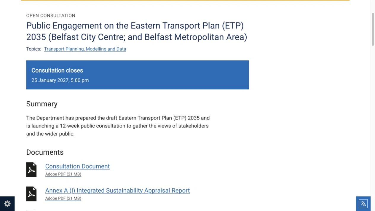
A public consultation on proposals for new Glider links, a wider 20mph zone and changes to pedestrian and vehicle access in Belfast opened on Monday 26 October 2026. Residents, commuters and businesses can now comment on the first phase of the Eastern Transport Plan 2035, with responses due by 5pm on Monday 25 January 2027.
Infrastructure Minister Liz Kimmins launched the draft plan alongside Northern Ireland’s Transport Strategy 2035. The Belfast proposals would change how street space is shared between people walking, wheeling and cycling, buses, deliveries and private vehicles. They include a Glider-only link through Royal Avenue and Donegall Place, new bus priority measures and a review of parking arrangements.
The launch was also covered locally by Love Belfast on 26 October. The immediate change is the opening of public consultation. The draft does not introduce new traffic restrictions today or establish a start date for every proposed scheme. Funding, detailed design and subsequent approval processes will determine how individual projects progress.
Which places are included?
The first phase covers Belfast city centre and the wider metropolitan area, including the continuous built-up areas of metropolitan Newtownabbey, Castlereagh and Lisburn. That distinction matters for people reading the plan from elsewhere in Counties Antrim and Down: the consultation is not a detailed transport programme for every town and village in the eastern region.
The wider Eastern Transport Plan is being developed with five councils: Belfast City; Antrim and Newtownabbey; Ards and North Down; Lisburn and Castlereagh; and Mid and East Antrim. DfI’s explanation of the plan’s scope and phasing says publication is being aligned with the councils’ Local Development Plans. Further consultations for the remaining areas will follow.
For someone travelling into Belfast from another district, the city-centre proposals may still be relevant. A journey can begin outside the consultation area but depend on bus stops, crossings, parking or an interchange inside it.
Where pedestrian priority would expand
The October consultation draft proposes a continuous walking and wheeling route through the city, described as a civic spine. In the south, this would connect Botanic Avenue, Dublin Road and Bedford Street. In the shopping core, improvements would include Royal Avenue, Donegall Place and parts of Donegall Square.
North Street, Bridge Street and Castle Place are also identified for improvements that would extend the area giving priority to walking and wheeling. Sections of Academy Street, York Lane, Library Street and Union Street are named for restrictions on traffic movements as part of the northern proposals.
The draft also identifies opportunities for more public space and seating around City Hall and outside St George’s Market. Changes to bus stands, through-traffic and crossings would be part of that wider redesign.
These proposals should be read together rather than as a simple list of streets closing. The plan combines pedestrian priority with access for public transport and necessary vehicle movements. The eventual design of crossings, loading arrangements and connections between streets will affect how useful the changes are for different users.
What the 20mph proposal would cover
The plan proposes extending the existing 20mph zone across streets within the city-centre boundary, while excluding Westlink and the M2/M3. It therefore does not propose a 20mph limit on those strategic roads.
DfI says slower speeds would be considered alongside changes to street design, including the number or width of traffic lanes. The proposal goes beyond installing signs: the document links reduced speeds with making walking, wheeling and cycling more attractive.
For drivers, the practical point is that this remains a consultation proposal. Current signs and restrictions continue to govern journeys. Publication of a draft plan does not itself alter the speed limit on a particular road.
How buses and Gliders could change
One of the most prominent proposals is a Glider-only link along Royal Avenue and Donegall Place, bringing rapid-transit passengers into the shopping core. The draft says vehicles would operate at very low speeds in that pedestrian-priority environment, with street design intended to manage the interaction between Gliders and people on foot.
Shore Road and Lisburn Road are identified as priority corridors for future Glider development. The plan anticipates further appraisal and design work on these routes. They should not be treated as newly operating services or as routes with confirmed opening dates.
The document also distinguishes its proposals from the separate Belfast Rapid Transit Phase 2 project. That distinction prevents existing Glider development work and the new consultation from being counted as the same fresh announcement.
For the wider bus network, the draft proposes simpler routes through the city centre and more bus lanes. Bus-only links around City Hall and improvements along routes such as Adelaide Street are intended to support more reliable journeys and better access to destinations.
Stops would be reviewed for seating, shelters and real-time information. Two additional travel hubs, in the north and south of the city centre, are proposed to complement the existing interchange network. Their locations and designs would require further development and engagement.
Cycling and the journey beyond a bus stop
The cycling proposals seek to join gaps between existing routes, new lanes and streets around the shopping core. The plan includes segregated routes where appropriate, alongside shared arrangements on some lower-speed streets and better cycle storage.
This is relevant to people who combine transport modes. A faster bus journey is only part of a useful trip if the walk from the stop is difficult, a crossing is inaccessible or a bicycle cannot be stored conveniently at the destination.
The draft treats those connections as part of the transport network. Readers assessing it can consider the whole journey: reaching a stop, changing services, crossing a major road and completing the final distance to work, shopping, education or an appointment.
Parking, deliveries and accessible access
The plan proposes reallocating some road space and on-street parking to support bus lanes, cycling and pedestrian improvements. A city-centre kerbside review would also consider accessible bays, taxis, coaches and tourist buses. The consultation includes Belfast City Council’s parking strategy as Annex B, which readers can examine alongside the new draft’s proposals.
Businesses therefore have a direct interest in the detail. Loading and servicing access are recognised in the draft, including in the shopping core, but the location and operation of that access would need to work alongside the proposed restrictions on through-traffic.
Blue Badge parking is a particularly important part of the consultation. DfI’s published questions and answers acknowledge that some spaces could move where car access is restricted, while stating an intention to improve provision nearby and increase the overall number of spaces.
That is a proposed approach, not a final street-by-street allocation. A replacement bay’s distance from a destination, the quality of the connecting footway and whether a crossing is usable can matter as much as the total number of bays.
The draft also anticipates additional residents’ parking zones around the centre, developed with local communities. Those proposals aim to address the possibility of commuter parking moving into nearby residential streets as central arrangements change.
What the plan means for commuters and local centres
Beyond the centre, the proposals include additional bus priority, new or expanded Park & Ride provision, cycling improvements and targeted 20mph zones in local centres. The department presents these measures as a connected network rather than isolated city-centre works.
People commuting at different times may experience that network differently. A route that works during the morning peak may be less useful for an early shift, an evening journey or a trip involving children or mobility equipment. Those are practical details that consultation responses can help identify.
DfI says necessary car journeys and freight movements remain part of the network. Its stated intention is to expand alternatives and reduce car journeys where a viable alternative exists, while retaining access for people and trips that require a vehicle.
Funding and delivery remain unresolved
The draft sets a direction towards 2035; it is not a fully funded construction schedule. DfI says the funding environment is uncertain and that a phasing and implementation plan will be developed to sequence delivery as money becomes available.
The department also distinguishes between a transport strategy, a geographically focused transport plan and the later design of individual schemes. That means support for a broad principle does not settle every question about a junction, loading bay or bus stop.
The consultation is the current opportunity to assess the overall package and the relationships between its parts. More detailed engagement and relevant statutory processes would follow as individual proposals develop. The published material does not justify promising a completion date or a guaranteed journey-time saving for a particular commuter.
How to read the documents and respond
The official consultation page provides the main draft and supporting documents, including environmental and equality-related assessments. It confirms the deadline of 5pm on 25 January 2027 and says late comments will not be accepted.
The department’s information is Crown copyright, available under its stated reuse terms. The proposals and assessments remain DfI’s published material; the explanations here are independently written.
An Easy Read version of the consultation document explains the plan’s purpose and main themes in shorter language. Alternative formats can be requested from the Transport Planning and Modelling Unit at TPMU@infrastructure-ni.gov.uk. The same unit can provide a paper copy of the survey.
The NI Direct consultation survey records the opening date as 26 October 2026. Readers can use that official route to submit their views directly to the department.
A useful response can identify the specific street, corridor or interchange involved, explain how a proposed change affects a real journey or business operation, and describe what would improve access. Comments about crossings, bus connections, deliveries or accessible parking are easier to assess when tied to a particular location and need.
For now, the verified development is that Belfast’s transport proposals are open for public scrutiny. The decisions on the final package, its funding and the detailed design of individual schemes remain ahead.

Join the conversation
Keep it kind, relevant and constructive. Comments are reviewed before they appear.
Be the first to share a thought.