

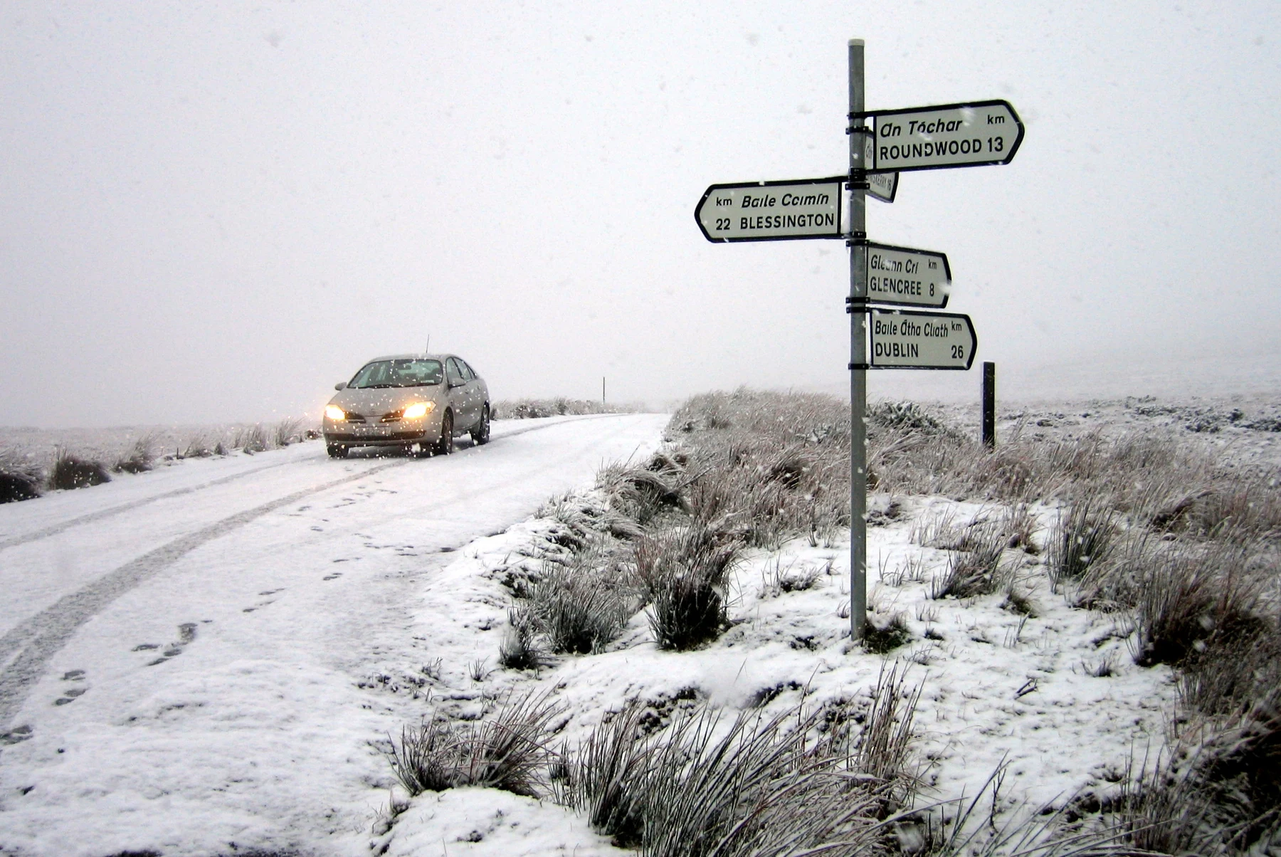
Yes, it snows in Ireland. The more useful question for a winter visit or an everyday journey is where, when and whether it will settle. Conditions on a mountain road can be very different from those at a coastal destination on the same day.
This guide explains the climate pattern and the practical checks to make before travelling. It is not a forecast of snow for a particular date or for winter 2026–27.
When is snow most likely?
Met Éireann’s climate overview identifies January and February as the months with the most frequent snow, while snowfall can also occur from November to April. The Atlantic influence moderates Ireland’s climate, but does not prevent cold spells.
Inland and higher locations are more exposed to settling snow than many coastal places. Warmer sea conditions can mean rain near the shore while snow falls farther inland; altitude also matters because temperatures generally decrease as ground rises. The pattern varies substantially between winters.
Met Éireann says snow usually remains on the ground for only a day or two, although notable spells have lasted much longer. Its linked November 2012 snowfall report is historical climate evidence. It is not a timetable for this winter.
A past winter is an example, not a prediction
The service’s winter 2024–25 statement records heavy snow early in January across parts of the south Midlands, South, Southwest and West, with snow remaining for several days in places. That illustrates how disruptive a spell can be without establishing what will happen on a future trip.
A snowy photograph from a previous year, a long-term climate average and a current local forecast provide three different kinds of information. Check which one a headline is showing before changing a booking or setting out to see snow.
Read the location and validity period of a warning
Use Met Éireann’s current warnings page for the live position, then read the affected areas, times and stated impacts. The agency’s warning-system explanation distinguishes localised danger at Yellow level, dangerous or disruptive conditions at Orange and extremely dangerous conditions at Red. Follow the official instructions attached to the event.
The explanation also stresses that impacts vary within a warning area. A county colour does not mean every road or neighbourhood will experience identical conditions. For Northern Ireland, warnings are issued by the UK Met Office; Met Éireann displays them, with Amber used there in place of Orange.
Plan the journey, including the way home
The Road Safety Authority’s severe-weather guidance advises considering whether a journey can be postponed during severe weather. If travel is unavoidable, visibility, suitable footwear and extra caution on icy surfaces matter for people walking as well as driving. A short trip to a stop or a parked car still involves outdoor surfaces.
Check the actual route and transport operator before leaving, rather than assuming that an ordinary timetable proves a service is running. Keep the return journey in the plan. A coastal starting point does not establish the conditions on an upland section farther along the route, and an attractive snow scene is not evidence that a road is safe to reach.
If plans depend on a high road, rural accommodation or an exposed outdoor activity, identify a lower-risk alternative and a point at which to cancel or change the plan. Use current official advice rather than an old screenshot of a forecast.
Make a few household preparations before a cold spell
The HSE’s severe-weather preparation guidance recommends keeping torches and batteries ready, checking batteries regularly and keeping mobile phones charged. Keep useful local contact numbers accessible too.
These are ordinary preparedness checks that can be done ahead of a disruption. They are different from attempting repairs: heating or electrical faults should be dealt with by an appropriately qualified professional. The aim is to have light, communications and a usable plan ready before conditions make errands more difficult.
Photograph: Sarah777’s public-domain image of Sally Gap, County Wicklow, taken on 15 December 2006. Resized and converted to WebP. It is an archive view of snow on an upland road, not a photograph of current weather.

Join the conversation
Keep it kind, relevant and constructive. Comments are reviewed before they appear.
Be the first to share a thought.